I have those Phillips maps. Have marked most places I delivered to in them. They were often borrowed by other drivers. When looking for somewhere new, I phone my TM and ask for directions.
There’s a good app for the I phone called viamichelen. It’s free and I use it a lot to find house addresses as I drive a recovery truck and some housing estates are a maze
The Force ![]()
DaiDap:
Homing pigeon.That’s if I haven’t killed it first
Ex pathfinder platoon! ![]() lick finger,
lick finger, ![]() stick it out of window and go that way
stick it out of window and go that way ![]()
![]()
I look up the end address on google maps to get an idea of the delivery. I stick the sat nav on but plan the route by map and if in doubt ignore the sat nav. (Except last week outside Newcastle when I believed it and it sent me off down the crappiest roads and i gave up and used the force.)
midlifetrucker:
I look up the end address on google maps to get an idea of the delivery. I stick the sat nav on but plan the route by map and if in doubt ignore the sat nav. (Except last week outside Newcastle when I believed it and it sent me off down the crappiest roads and i gave up and used the force.)
Should have said you were in Newcastle could have directed you ![]()
![]()
![]()
![]()
Alway check if you can go down that road before turning if in doubt
Have a map also a basic sat nat gives an eta but also use the Mark One eyeball read the road signs apply some common sense
Dont have a phone that supports an app as it is a basic phone which I like
midlifetrucker:
I look up the end address on google maps to get an idea of the delivery. I stick the sat nav on but plan the route by map and if in doubt ignore the sat nav. (Except last week outside Newcastle when I believed it and it sent me off down the crappiest roads and i gave up and used the force.)
most sensible thing nowadays is google said firm on Internet, and by magic everything pops up, address, phone number and directions! ![]() too easy!
too easy! ![]()
![]()
For those drivers that really have been to the middle of nowhere…
How do you navigate when you’ve got no mobile signal?
Iphones have the habit of not having a mast nearby when you REALLY need them to be connected I reckon.
They are not satellite uplink phones after all.
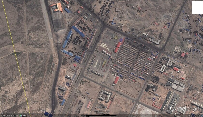
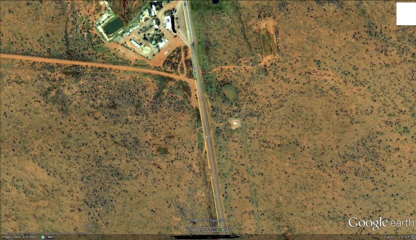
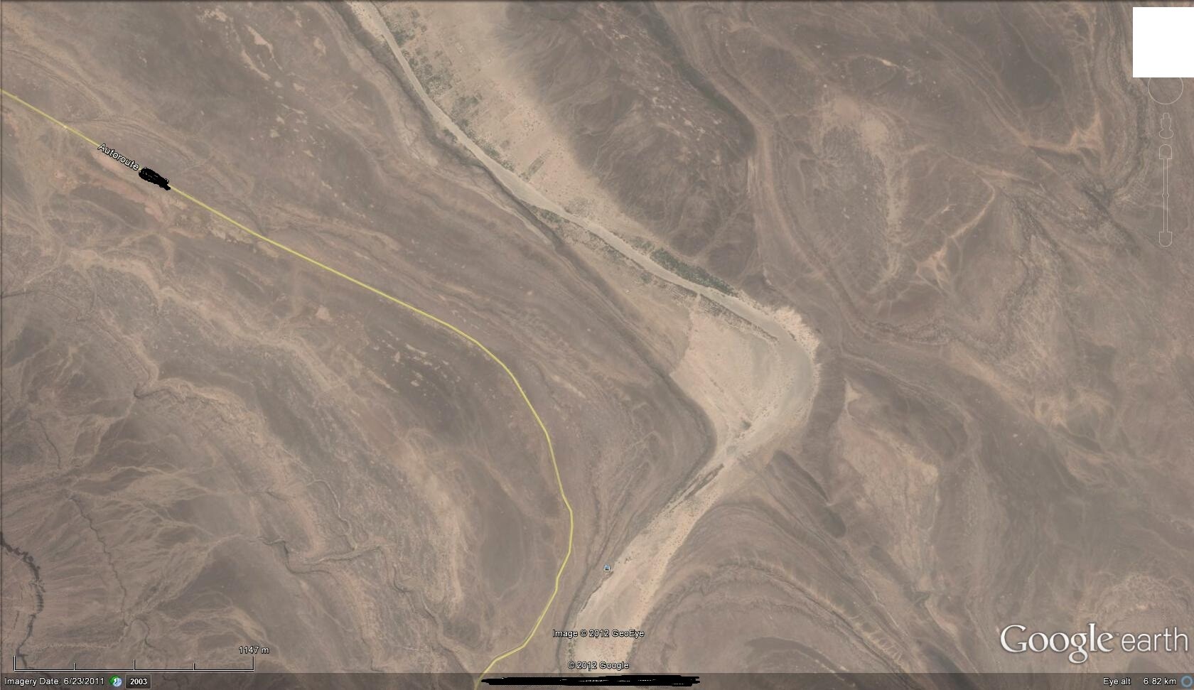
Here’s 3 mystery places.
See who can work out
(1) What country/state is each pic (Town/road name not required.)
(2) Which way is north.
There are no mobile masts at any of these locations, but you can clearly see trucks and a fuel station in two of them.
All three areas of course show desert areas with main roads for the area on each.
Being able to navigate by the stars/sun (clear skies common at all 3 locations) is clearly a bonus here. A roadmap won’t do you much good, nor a standard mobile device. a 5-figure full blown satellite phone maybe… I wouldn’t think many of us have one of those though. ![]()
(A)
(B)
(C)
ask on here with that many drivers someone has been there before …
google
sat nav. ring 118118 or any other relaible number to get proper postcode not always the one on delivery notes
what i find really good is a place i have never been to before , is even when you get really lost.place takes ages to find etc etc its a breeze getting home
-
Physical map + Common sense = takes precedence over all else.
-
Then sat nav as a secondary tool, and to help with ETA and bridge heights/weight limits. If there were any possible bridges on the paper map, then I’ll run a demo of the route to double check. If the route shows any bridges too low, then it’s out with the old paper map again and write my own directions down on a piece of paper, and follow those - ignoring the sat nav at said point.
-
A simple google search can be handy to double check the company name/ postcode/telephone/street name if your intuition starts to tell you that something’s not quite right…
Although I’m more of a methodical person who would hate to admit this, intuition IS pretty important. Office planners tend to mis-spell or just put the address plain wrong a lot of the time ![]() . You could very easily just punch in a postcode, follow it blindly, and by the time she says “You have reached your destination”, where you really are is in the middle of a field with sheep and cows milling around you… Not a person for miles & no phone signal (no joke).
. You could very easily just punch in a postcode, follow it blindly, and by the time she says “You have reached your destination”, where you really are is in the middle of a field with sheep and cows milling around you… Not a person for miles & no phone signal (no joke).
I don’t get paid enough to afford a phone which can handle google earth/google maps yet (and certainly not a laptop!) but I can imagine that must make life so much easier.
As an absolute last resort I’ll get out and ask people. But I’ve had some very bad experiences with trusting peoples’ directions in the past, so it seldom comes to that… and if I have to do it, I’ll be discerning about whom I choose to ask. Snack vans are usually spot on for industrial estates… or postmen in general.
By that stage I’m usually pretty near the place anyway - just the last couple of exact streets/turns/“which unmarked building is it?” that’s needed.
FarnboroughBoy11:
I use a map, road signs and I remember the route and used to use my phone for maps if im not sure. Not any more though because the new iso6 update is crap, there’s no more street view, no junction numbers, nothing. It used to be google maps but now apple have bought their own out and it’s not as good. In fact it’s awful.
It will be improved though, don’t worry. It’s been fine for me though.
There is numerous map apps in the AppStore that will give you street view or you can just use the google maps via your safari browser…
Map first and foremost. Sat nav for last minute guidance and Google Earth street view. Even for Romania and it still showed me the buildings I needed before leaving my house. The amount of time you save, just by knowing what your destination looks like! ![]()
If you’re asking for directions, anyone walking a dog is usually a good bet, as they tend to be local (!)
if you have the address just use a bluddy truck sat nav and stop messing about
with paper maps
this is 2013
if it looks like the road is not suitable dont go down it
and the sat nav will re route you
comprehendez
Like most here I use Google Streetview, truck satnav, atlas and my noggin.
Street maps and the good old fashioned mark 1 eyeball, mark street maps with useful info such as bridge heights or “nlta”, in my car transporter days that meant no left turn for artic but a drag was good for the turn.
Another twist on the asking for directions is phone another driver, at least then there is a chance of speaking with someone who knows you can’t fit through the 6’ 6" bollard protected high street or under a 12’ bridge with a 16 foot tautliner or bust the back of a 3 tonne limit bridge.
Postal workers and estate agents always paid dividends for me, most of the folk on foot were the spam tin round the neck variety and I soon learned why they were on foot and not sitting in a 4 wheel tin box going to their destination.
When I was doing Palletforce deliveries the majority were regulars. Most days, however, there would be one or two mysteries, and I always tried to phone them before leaving the office.
Many times they would want the delivery at a different place to the address on the paperwork, have to arrange for someone to be there to unload and/or have some useful information about the best route to use.
The post code, especially in country areas, can be miles away from the actual place.
Google Maps, then use Sat and Streetview to check access to site or building, then zoom out further and check local surrounding for potential bridges and weight restrictions (dependant on whether it is a built up area or out in the sticks)
I used to have a massive weights and bridges map which I carted around with me all over the place, being an agency driver for a long time it was just a PITA tho as you could never just leave it in the truck, I now keep a small compact map in my bag just to backup Google in case I lose mobile coverage or GPS or some other such problem, I do not tend to need a map to do the navigation bit, just the last few miles if it somewhere new maybe.
Recently got a truck nav which I have bought for the sole purpose of keeping me on the right side of the law with unexpected weight and bridge problems, not that I ever had a big problem before but it is a nice backup and confirmation your gonna be ok - if nothing else ![]()
In reflection, how the hell I ever found anything back in the day I don’t know lol, back then it was map to get you to the city/town, then stop at local petrol station and either ask or buy a local red book map, I had dozens and dozens of those blasted things lol, the days of spending 2hrs looking for somewhere on a bad day are long gone thankfully ![]()
In my job I cover an area west of an imaginary line from aberystwyth to carmarthen & have a pretty in depth knowledge of the whole area, I use a Phillips map of the area too which is an essential, I think I’ve driven just about every road here , you can’t get lost here ,just go round in circles, if you need directions down this way just pm.
I use the good old phillips truckers atlas and my sat nav ,plan the route in the atlas checking for bridges and restrictions and then see if the prat nav agrees with the way I’m going 9 times out of 10 it dont so tend to trust the atlas and only use the prat nav for the last mile or so