Heading north out of W/ton tc towards Maryport. AFAIK there’s only 1 road over the river bridge. Sorry if it wasn’t clear.
… and as for the road bridge, think of Michael Caine’s voice in The Italian Job:
“How was I to know they’d taken the bloody bridge out”?
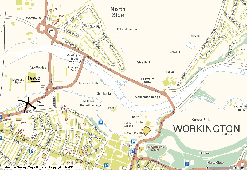
I cant even find police station road!
scantheman:
I cant even find police station road!
Hall Brow. Down hill after turning right off the 66.
I suspect all Driveroneuk has done is explain the route from the Curwen to Thames Board as it was before the bridges were down. No need for Sat Nav or Google Earth anyway as they still haven’t been updated. Transportdirect website has been though…
For the first few months there was no vehicular access across the river at all and Northside Road was one-way only towards Workington Bridge, (the one in danger of imminent collapse with Sky News choppers hovering over it for a fortnight waiting for it to go, but it didn’t

) giving you no option but to go through Seaton…with a choice of 2 low bridges, 13’ 6" and 13’9". Hands up all those who had to go through Camerton!

That explains it all…cheers mate!
Al
Bloody hell, just read this thread sober! 
Which ever route Ady1 uses to get to Whitehaven, be it via Penrith, Carlisle, or even God forbid Barrow  he won’t be anywhere near Workington!